-
 2023. April VOL. 661
Most of the streams on Jeju Island dry up quickly. Rain and snow get quickly absorbed underground due to the island’s geological characteristics resulting from frequent volcanic activities that once occurred in the past. For this reason, you can rarely see a running stream on the island except during the wet season frequented by rain showers. Despite the most rainfall in the country, Jeju Island residents have suffered chronic water shortages including not only drinking water but also residential water because the terrain makes it impossible to hold rainwater in a reservoir or stream. There is a local saying that ‘if you waste water when you wash your face, you will end up drinking all the water you wasted after you die as penitence.’
The Jeju Island is shaped long oval like a rugby ball, being shorter in distance stretching from south to north than east to west centering on Hallasan Mountain. Many of the streams are located vertically across the island with the distance shorter stretching from south to north, with the ground more slanted than elsewhere. The streams to the north are concentrated within a 10km radius from Jeju-si and those to the south within a 20km radius from Seogwipo-si.
Hallasan Mountain dominates over Jeju Island’s landscape, but the oldest mountain is Sanbangsan Mountain that towers like a bell at the southern tip of the island. There is a legend that Sanbangsan Mountain was formed later than Hallasan Mountain, which is not true. Legend has it that the Great Jade Emperor was shot by an arrow, pulled it out and threw it away, forming Sanbangsan Mountain. But in fact, Seogwipo’s formation is the stratum that forms the base of the island’s geography, and its representative is Sanbangsan Mountain.
The first place on my itinerary was Sanbangsan Mountain because I wanted to get a glimpse of what the island looked like in its formative years. If you stand at Sanbanggulsa Temple located on the slope of the mountain, you can get a full view of Yongmeori Beach shaped like the head of a dragon sinking into the sea.
The beach will make a powerful first impression on you. According to a legend, there was a man who knew there was something mysterious about these odd-looking rocks. Qin Shi Huang of China was told that a king would be born on Jeju Island and sent a geomancy specialist Ho Jong Dan to Jeju Island to kill him. Ho Jong Dan cut off his critical blood vessels and a gush of blood spurted out, painting the area red. This is why the rocks of Yongmeori Beach are dark orange in color. The beach is also geologically important. The beach together with Sanbangsan Mountain, one of the oldest volcanic edifices, was created far earlier than Hallasan Mountain. The beach featuring rocks and cliffs in odd, unique shapes, is reminiscent of the Grand Canyon on a small scale.
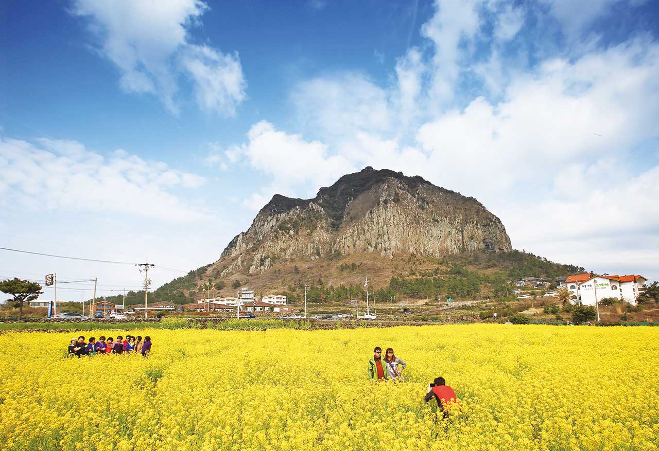 Canola Flower Fields on Sanbangsan Mountain in Jeju Island

There are a few places on Jeju Island where you can see powerful waterfalls. On your travels in the Seogwipo area along the southern coast, you will see some beautiful waterfalls. Jeju Island is characterized by spring water and waterfalls which abound notably more on the island than any other part of the country.
Unlike the streams in other regions, those on Jeju Island remain hidden due to flowing underground all the way down to lower areas, keeping the soil moist.
Known as a major spring waterfall, it is made up of three falls. Water doesn’t flow out of the first waterfall except during the wet season. Instead, spring water continues to flow out of the columnar joints and fall into Cheonjeyeon pond that is 21m deep. The combination of the uniquely shaped precipice and the emerald pond makes a uniquely enchanting scene that is found nowhere else. Large volumes of water from the second and third waterfalls flow out of the cliffs.
The name Cheonjiyeonpokpo Falls has a special meaning, ‘a pond that Heaven and Earth met to create’, and describes the beauty of the fall as exceptional and unmatched. And the waterfall is certainly worthy of its name. The water falls from a 22m cliff into a 20m-deep pond, and the height of the cliff is matched by the water depth of the pond. As the name describes, Heaven and Earth met in the pond. The dense, warm-temperature forest surrounding Cheonjiyeonpokpo Falls is designated·preserved as Natural Monument No. 379. In the Cheonjiyeonpokpo Falls live giant mottled eels designated as Natural Monument No. 27, which are 2m long and 20kg heavy. The diadromous fish hide deep in the water in the daytime because they are sensitive to light, and swim up to shallow water to catch prey at night.
Jeongbangpokpo Falls is one of the three major waterfalls on Jeju Island, with the other two being Cheonjeyeonpokpo Falls and Cheonjiyeonpokpo Falls. You can hear the roaring sound of the waterfalls as soon as you start to walk down the stairs past the ticket office. The waterfalls flow from a 23m cliff and plunges 5m deep into the pond. It is the only waterfall that flows right into the sea. The columnar joints on both sides of the waterfall stand perpendicularly to the pond, looking mysterious and unreal.
A phrase ‘Seo Bul Gwa Cha(徐巿過此)’ is engraved on the precipice to the west of Jeongbangpokpo Falls, which means, ‘Seo Bul has been here.’ Legend has it that Seo Bul and his team came to Jeju Island looking for an elixir plant on the orders of Qin Shi Huang.
 Canola Flower Fields on Sanbangsan Mountain in Jeju Island

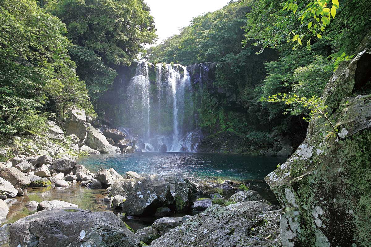
 Second Cheonjeyeonpokpo Falls
K-water entered into an agreement with the Jeju Island municipal government in 2015 to help deal with water issues in Jeju Island. Under the agreement, it is tasked to manage a project to raise the water flow rate in the island’s water supply system. K-water launched a water flow rate-improving pilot project in Goji, Aewol-eup, and Topyeong-dong in Seogwipo-si in 2016, followed by full-scale water flow rate-enhancement projects in the entire area of Aewol-eup in 2017, Hallim-eup·Hangyeong-myeon in 2018, and Daejeong-eup, Andeok-myeon and Jocheon-eup in 2019.
K-water has been working to improve the water flow rates in Jeju-si and Seogwipo-si, the two most densely populated areas on Jeju Island, and to modernize the local water supply system in the western area of Jeju-si since 2020. The goal is to increase the water flow rates to 65% to 70% in eup·myeon, and up to 75% in Jeju-si and Seogwipo-si, and to raise the rates to 85% in the target areas of the modernization project.
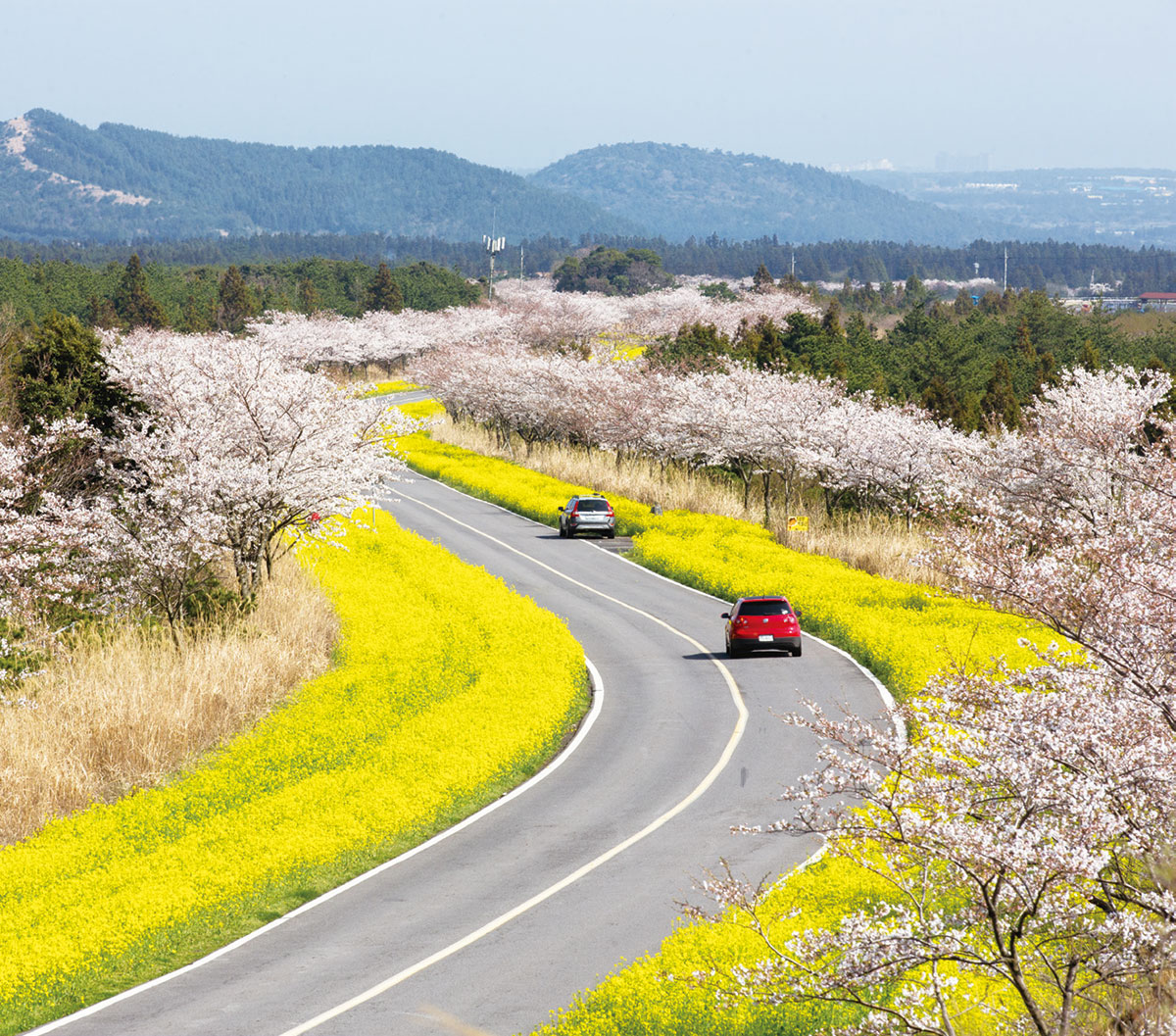
Canola flowers and cherry blossoms unfold endlessly along the road, creating a springtime spectacle. Selected among the ‘100 beautiful roads in S. Korea’, the road has been voted one of the most popular courses to go for a drive in April. Visitors are fascinated by the dreamy landscape that unfolds along the two-lane road lined with bright yellow canola flowers and light pink cherry blossoms on both sides. The Canola Flower Festival is held when the flowers are in full bloom, and Seongeup Historic Village nearby is also worth a visit.
![]() Address 87-15, Gasi-ri, Pyoseon-myeon, Seogwipo-si, Jeju-do
Address 87-15, Gasi-ri, Pyoseon-myeon, Seogwipo-si, Jeju-do
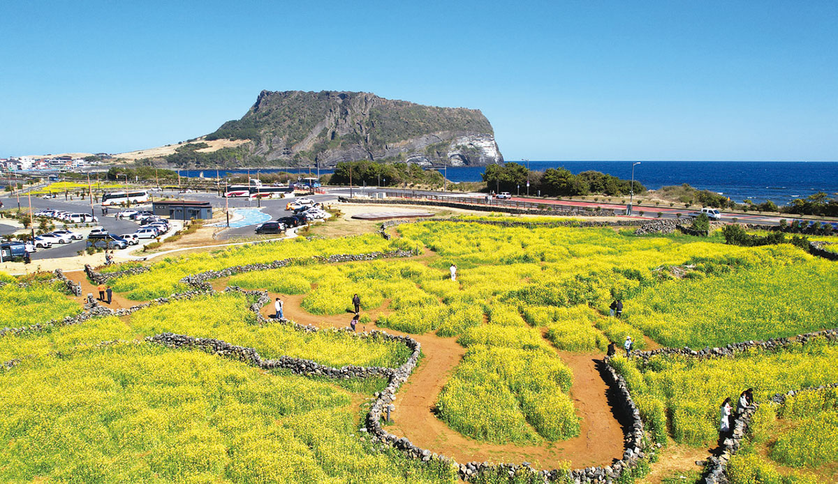
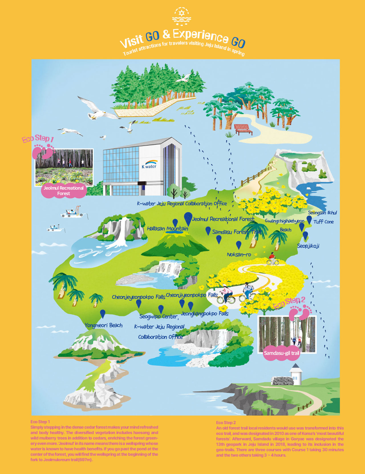
If you depart from Seongsan Ilchulbong Tuff Cone, you will come upon Gwangchigihaebyeon Beach on the way to Cape Seopjikoji, where you can get a scenic view of the entire Seongsan Ilchulbong Tuff Cone. It is an ideal spot from which you can view the unique geological structure formed when scorching lava flowed into the seawater and cooled down rapidly, and the beautiful sunrise emerging majestically against the backdrop of Seongsan Ilchulbong Tuff Cone. In spring, canola flowers paint the area yellow, creating a spectacular scenic landscape unique to Jeju Island.
![]() Address 63 Seopjicoji-ro, Seongsan-eup, Seogwipo-si, Jeju-do
Address 63 Seopjicoji-ro, Seongsan-eup, Seogwipo-si, Jeju-do
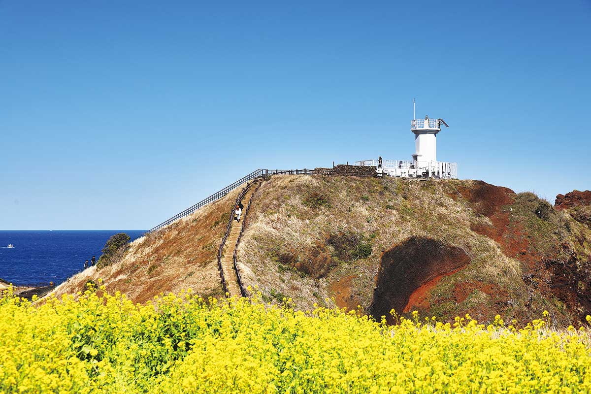
Together with Seongsan Ilchulbong Tuff Cone, it boasts the best view on the eastern coast of Jeju Island. On top of the low hill, you will enjoy a breathtaking panoramic view of the ocean and canola flower fields in full blossom, a beacon, and a white lighthouse. It is by far one of the must-visit spots on your travels in Jeju Island in April. The lighthouse observatory overlooks odd-shaped rocks revealing themselves briefly as the waves roll in and out, making the scenic landscape even more magical and enchanting.
![]() Address 107 Seopjikoji-ro, Seongsan-eup, Seogwipo-si, Jeju-do
Address 107 Seopjikoji-ro, Seongsan-eup, Seogwipo-si, Jeju-do
