-
 2023. May VOL. 662
You have to take Local Road 460 to get to Hwacheon-gun and the Peace Dam. Along the road is Haesanryeung Pass known for the 99 crooked road. Spring reaches full bloom late and fall arrives early at the peak of this tall pass nestled deep in the mountain. As the mountain peaks get higher, the valleys are carved deeper, making it an ideal place as a getaway from the summer heat. Haesan Mountain(1,194m) is a place where you can see the sunrise before anywhere else in Hwacheon-gun. For this reason, it is also called ‘Ilsan’ meaning ‘mountain of the sun.’
It used to be called ‘Mountain of Tigers’ way back in the olden days because tigers used to live in this thick forest. This explains why the tiger-shaped structure is set up at the observatory near Haesan Tunnel.
The creation of Paroho Lake at the foot of Haesanryeung Pass resulted in Bisugumi village being isolated as a remote and secluded village. To get to the village, you have to park your car at the rest spot on Haesanryeung Pass, and walk on the 6km unpaved road that leads to the village. Otherwise, you have to ride a ferry boat across Paroho Lake. The unpaved road on the way to the village is known as a healing spot. In the tranquil and secluded forest where mobile phone reception is lost, all you can hear is the water, birds and winds. The road stretches downhill from its beginning until 6km in distance from the village where it ends. You have to walk along an uphill path to get back to the rest spot where the car is parked. If the sunlight beaming down on your head is too hot, you can go down to a valley and soak your feet in the clean and cold water. Now that you are miles from a city, it is an ideal time to take a respite and relax.
Paroho Lake is a must-visit place in Hwacheon-gun. Around this time of the year 72 years ago, North Korea launched attacks in ‘April’ and ‘May’ on the heels of the human wave battle strategy of the Communist Chinese army. The UN forces launched a counteroffensive, and the South Korean army were engaged in fierce battles day and night from May 26 to 28, 1951. The South Korean forces managed victories in battle, and won a major victory by defeating three divisions of the Chinese forces, despite its inferiority in firepower and troop size.
President Syngman Rhee named the lake ‘Paroho Lake’, meaning ‘the lake where the South Korean army defeated the Orangke(foreign invaders in Korean).’ You can learn about the Paroho Lake Battle at the Paroho Lake Museum. If you walk 150m along the sloped trail behind the museum, you will reach the observatory from which you can enjoy a bird’s eye view of the lake. From the observatory overlooking the lake, you can get immersed in the scenery as you gaze at the lake surrounded by Ilsan Mountain(1,140m), Duryubong Peak(426.6m) and Gubongsan Mountain(396.5m), which resembles an ocean in the midst of mountains.
Besides savoring the view of the lake from the observatory, you can also go on a boat cruise, which is operated on the 23km(one-way route) from the Paroho Lake wharf to the Peace Dam. During the cruise, you can view scenic landscapes including Squirrel Island and Bisugumi Village up close, while looking at the Peace Dam and surrounding areas as well. A third option is to go water skiing and wake boarding on the lake itself by truly getting up close and personal with nature.
Wakeboarding which may not be familiar to many Koreans reaches greater speeds than water skiing does, adding to the sense of thrill. Imagine yourself skimming on the water of Paroho Lake and raising a cloud of a spray. Even the thought of wakeboarding alone can revitalize your spirits. The last way to enjoy the lake is to eat local food cooked with fresh ingredients obtained from and around the lake. There are several seafood restaurants serving raw fish and fish stews near Paroho Lake wharf.
The Peace Dam is another must-visit place. When North Korea built the Imnam Dam(Geumgangsan Dam) in the upper region of the river, South Korea constructed the Peace Dam, the tallest dam(125m) in South Korea ever built to primarily deter the flooding in case of the Inman Dam’s collapse. In January 2002, North Korea discharged large quantities of water without prior notice to South Korea in the process of repairing the Imnam Dam. As a result, 50 times the average amount of water volume was released into the Peace Dam, which successfully performed its role of protecting citizens from water disasters, thereby avoiding any casualties or property damage.
In addition, K-water offers various sights to see and enjoy by taking advantage of the Peace Dam. One of the things to see is ‘The Gate to Unification’ painted on the concrete wall of the dam. Seen from a distance, the art work in the format of trick art looks so realistic, and is listed on the Guinness Book of Records as the world’s largest wall(4,774.7㎡) painting. The Peace Dam not only serves as a security and peace keeper, but also is used as a waterfront space that allows people to fully appreciate and benefit from all that Mother Nature has to offer.
The true beauty of Hwacheon-gun lies in its pristine clean nature, in which water and mountains are in perfect harmony. The road also known as ‘Oxygen Road’ features the beautiful sceneries of Hwacheon-gun that unfolds along the waterway. The road that connects 18 cities and counties in Gwangwon-do leads to ‘the Bridge to the Forest’ at the Bukhangang River in Hwacheon-gun. The bridge was named by the author of <Nahansanseong Fortress> and <the Song of the Sword>, Hoon Kim. As an avid bike traveler, Kim traveled across the country, and wrote the book <Bike Travel> based on his personal experiences. How is Hwacheon-gun depicted in his book? What did he see and feel as he traveled around Hwacheon-gun on his bike? The mountains and fields in the county were once battlefields, but now there are no traces of the battles.
But we still remember the battles all too well. The deeper the scar is, the greater the remorse, regrets and yearnings get. Try and listen to the songs of the Bukhangang River as you walk on the ‘Bridge to the Forest’ that stretches 1.2km above the river. The thick, dense greenery blurs the boundaries of the forests and the river. That is probably why the novelist named it the Bridge to the Forest. In Hwacheon-gun where nature is preserved in its primitive, original form, the forests and water are inseparable.
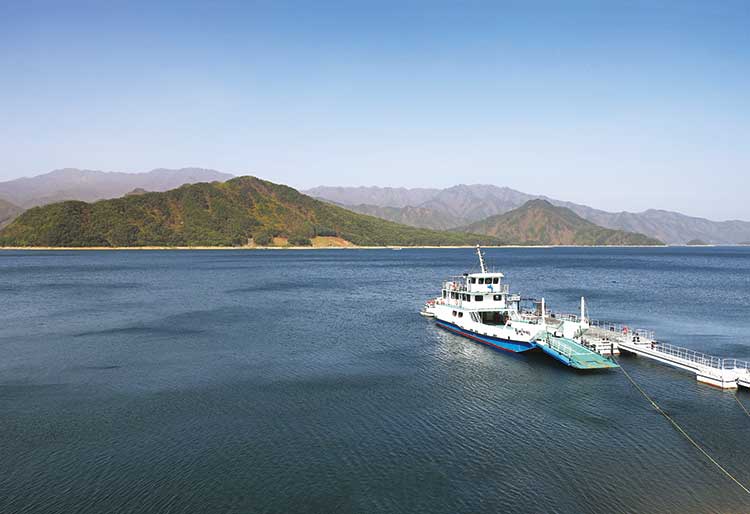 Paroho Lake Wharf

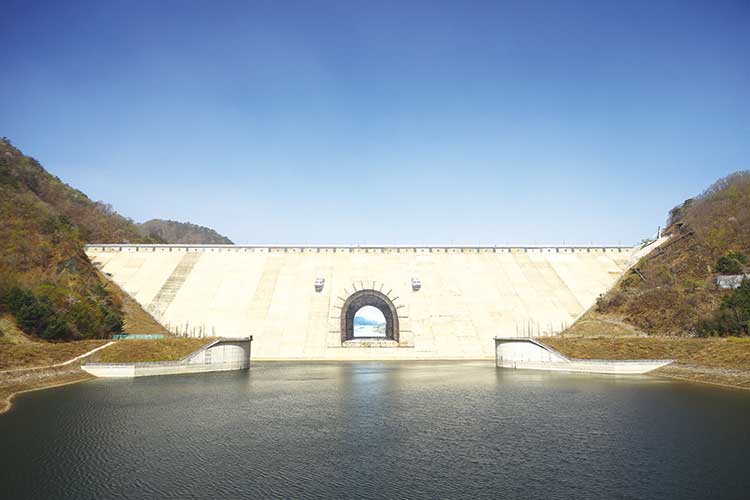
 The Peace Dam
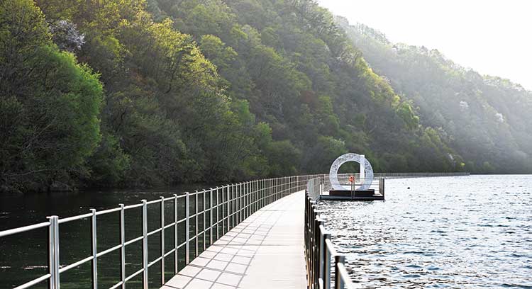 The Bridge to the Forest
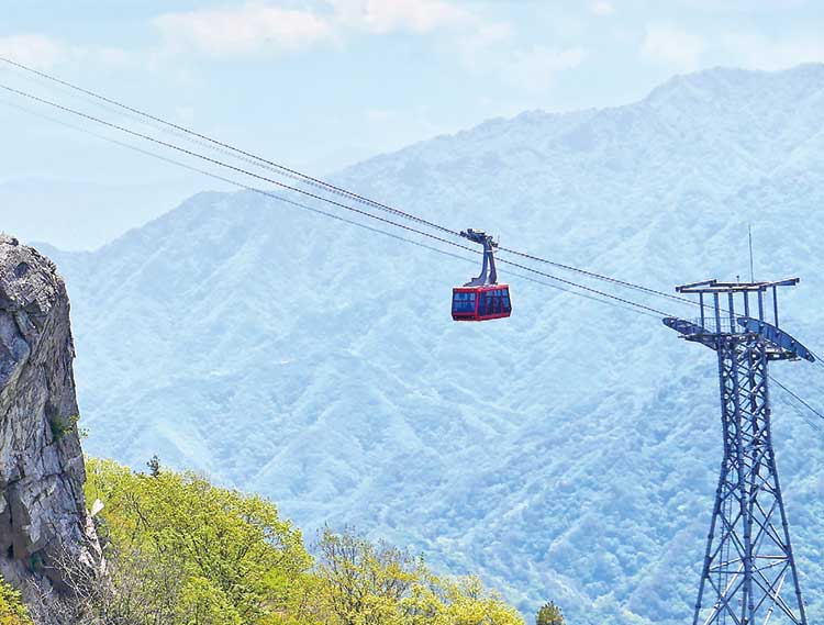
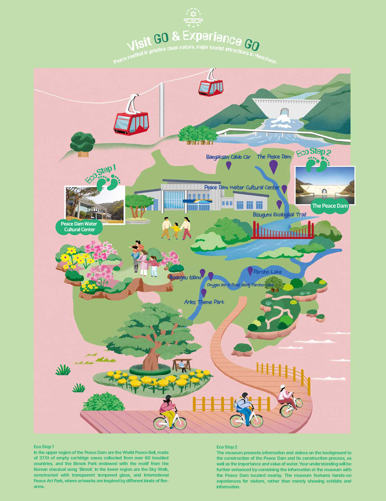
Korea’s northernmost cable car reaches the highest spot(1,178m) among all cable cars in the country. Its total seating capacity is 46 people, but only up to 40 people are allowed to board the cable car for safety reasons. It runs the one-way route stretching 2.217km which allows visitors to enjoy the breathtaking scenery that has long been hidden from public view. At the top of Baegamsan Mountain, you can see the Peace Dam and Geumgangsan Dam.
![]() Address 1285-89 Hanmungnyeong-ro, Hwacheon-eup, Hwacheon-gun, Gangwon-do
Address 1285-89 Hanmungnyeong-ro, Hwacheon-eup, Hwacheon-gun, Gangwon-do
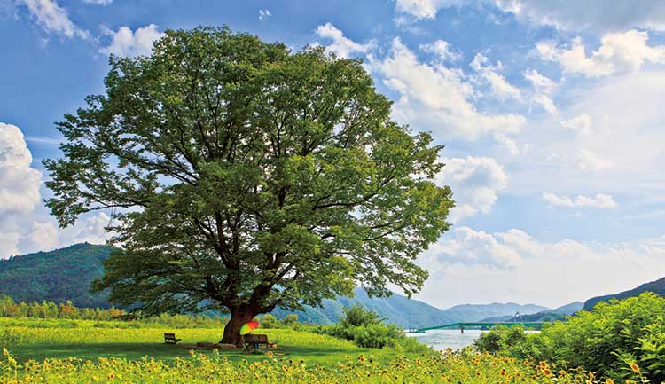
The Arles theme park spans an area that borders Bukhangang River. A lone zelkova tree standing tall by the river which was featured in a music video is a popular landmark among photography enthusiasts. You can walk along the river or amid the zelkova forest to enjoy the tranquil late spring scenery.
![]() Address 514-1 Georae-ri, Hanam-myeon, Hwacheon-gun, Gangwon-do
Address 514-1 Georae-ri, Hanam-myeon, Hwacheon-gun, Gangwon-do
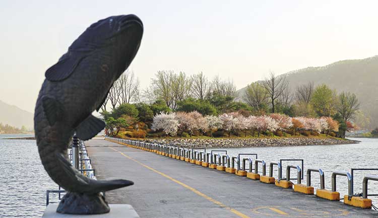
It is an island in the middle of the Bukhangang River connected to the mainland by a bridge. It is called ‘Boongeu Island’ because crucian carps were commonly found in the river (‘Boongeu’ means crucian carps in Korean). The island is a great destination for leisure and recreation all year-round. It is also a popular venue for photographers and a favorite picnic spot for couples and families.
![]() Address 169 Ha-ri, Hwacheon-eup, Hwacheon-gun, Gangwon-do
Address 169 Ha-ri, Hwacheon-eup, Hwacheon-gun, Gangwon-do
