-
 2023. Nov VOL.668
- 2023. Nov VOL.668
- ENG
-

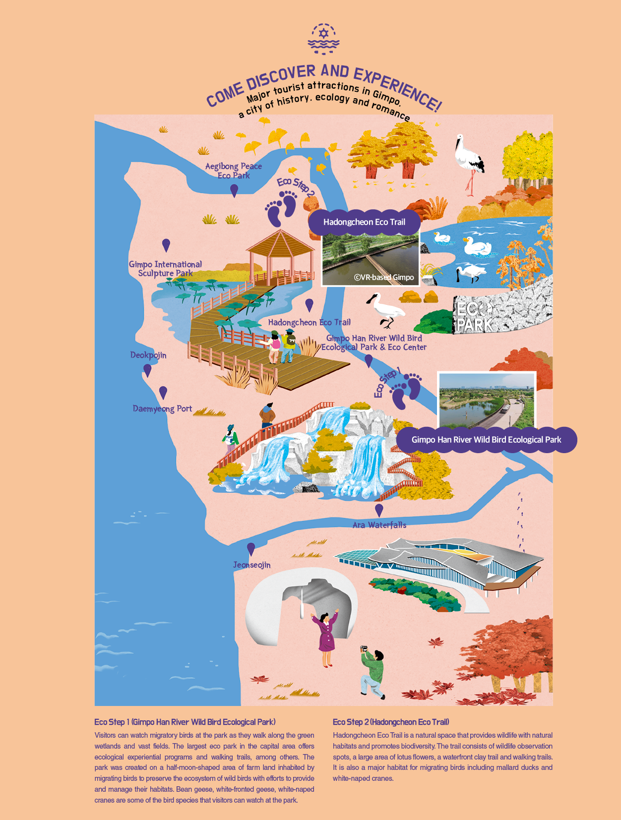
The three rivers of the Hangang, Imjingang and Yeseonggang converge at Gimpo from which the combined waters continue to flow into the West Sea. Looking down from a viewpoint at the northernmost tip of Gimpo offers a rare glimpse of the winding waterways uniting together and subsequently flowing down as one. Aegibong is a relatively low mountain peak at 154m high. If one looks across the river from this peak, they can see Gaepung-gun, Hwanghaebuk-do Province in North Korea, which is only 1.4km away. From an aerial view of Gimpo and the surrounding area from the peak, one can easily see why Gimpo was considered the first line of defense in times of foreign invasions. Foreign invaders who entered Korea through the West Sea could only reach the Hangang River by passing through Gimpo. Strategic site No. 154 where the North and South engaged in a fierce battle during the Korean War is in Gimpo. If one plans to climb to Aegibong Peak, Aegibong Peace and Ecopark is also worth a visit. After the old Aegibong Observatory was torn down, Peace Eco Exhibition Hall, Jogang Observatory and eco trails were newly created in 2021 within the park. The buildings designed by the world-renowned architect Hyosang Seung blend seamlessly with the surrounding nature to create a space dedicated to the promotion of peace.
Taking a walk around Aegibong will likely lead to Jogang Observatory. A “propaganda village” set up by North Korea in Gaepung-gun, Hwanghaebuk-do Province can be clearly seen through the telescopes installed at the rooftop, making the buildings and military posts in the village appear so close. Since the park is located within the civilian-restricted zone, visitors must present their ID to enter the park.
Due to its close proximity to the sea, ‘Gimpo’ is rarely associated with rivers. To fully appreciate it as a city of history and ecology, some knowledge of the Jogang River can be useful. Aegibong overlooks the river that flows around it. Located between Siam-ri Haseong-myeon and Yudo, an islet in Bogugot-ri, Wolgot-myeon, the river rendezvous with the Hangang River and Imjinggang River to flow down to the West Sea.
‘Jogang’ means an ‘enormous river’ that is as vast as an ocean, as well as meaning ‘grandfather’s river’ and ‘the top river’ that brings together all the branches of the Hanggang River. There is a big quay at the river. There used to be a thriving village where more than 100 households lived. Prior to the outbreak of the Korean War, the village and the quay served as the center of waterway traffic and logistics in the Hangang River estuary. However, access to this area has been strictly restricted since it was declared as ‘the Neutral Waters of the Hangang River Estuary’ under the armistice treaty reached in 1953 between North and South Korea, which brought the Korean War to a close. In other words, the area has been spared from human interference for decades. Without human contact, the Jogang has healed all the wounds of war and restored the pristine order of nature. Now, the river has become an ecological treasure trove where many of the world’s endangered species inhabit and thrive. In a sense, a tragedy to humanity has provided an opportunity for animals and plants to flourish.

One of the best ways to make the most out of one’s travel to Gimpo is walking along the Peace Nuri Trail. Courses 1 through 3 of the said trail running through Gimpo allow visitors to learn about history, culture and ecology of Gimpo. Course 1 stretching along the barbed wire fence combines the trails along rice paddies and mountain trails. Course 2 features mountain trails that stretch up and down along a fortress. Course 3 starts at the foot of Aegibong, and extends past the community center of Mageunpo-ri, the wintering site for white-naped cranes at the lower reach of the Hangang River, and the coal drainage pump station to Jeollyu-ri. Throughout the course, visitors can view the Hangang River flowing quietly over the barbed wire fence.
Course 1 starts from Daemyeong Port, and stretches along the barbed wire fence path along the Yeomhwagang River. The barbed wire fence stretches for miles near the DMZ along the Yeomhagang River running between Gimpo and Ganghwa. Despite the barbed wire fence, the course is dubbed ‘the Riverside Trekking Trail’ as it offers a strikingly scenic combination of rivers and mountains.
Deokpojin Fort is probably the first place to visit, and is located at the center of the waterway leading to Hanyang, which is the narrowest strait of Ganghwa Strait facing Ganghwado Island. More than 300 soldiers were stationed at a military camp in Deokpojin in the Joseon dynasty. During the French military campaign against Korea in 1866, the soldiers in Deokpojin fought against French battleships and many of them died in the battle against American battleships that invaded Korea in 1871. During the French campaign, the French navy invaded Ganghwado Island through this waterway to steal books from Oegyujanggak, a royal library set up on the island. In 2011, France finally returned 297 books stolen by the French navy to South Korea.
The Shinmiyangyo, the U.S. military action against Korea in the year of Shinmi (1871) occurred as the U.S. expedition turned into an armed conflict following the attack of the Korean military and civilians that ended in the U.S. merchant ship General Sherman being set ablaze on the Daedonggang River. The U.S. fleet entered Ganghwa Strait to survey the strait, leading to a fierce artillery battle. The U.S. fleet landed on Chojijin Fort in Gilsan-myeon, Ganghwa-gun. In the ensuing conflicts that arose between the U.S. and Korean troops, 53 Korean soldiers lost their lives and three U.S. soldiers were killed, leaving more than 10 injured. Eventually, Korean troops drove the U.S. fleet out of Korea after intensely fighting for over 40 days. From a sense of pride in winning the battle, Daewongun erected Stele Condemning Reconciliation across the country, and reinforced his stance on a closed-door policy.
During a walk on the Jogang Barbed Wire Fence Trail of Course 2, visitors will find Munsusanseong Fortress, a living testimony to the battles against the French invasion in 1866. The fortress was once occupied by the French after winning the battle there. Built on a mountain 376m above sea level, the fortress is called “Geumgansan Mountain of Gimpo” for the beautiful landscape throughout the year. The top of the fortress, where the commander led his forces in battle, was restored in 2022 after it had been used as a miliary heliport since the Korean War ended in 1953.
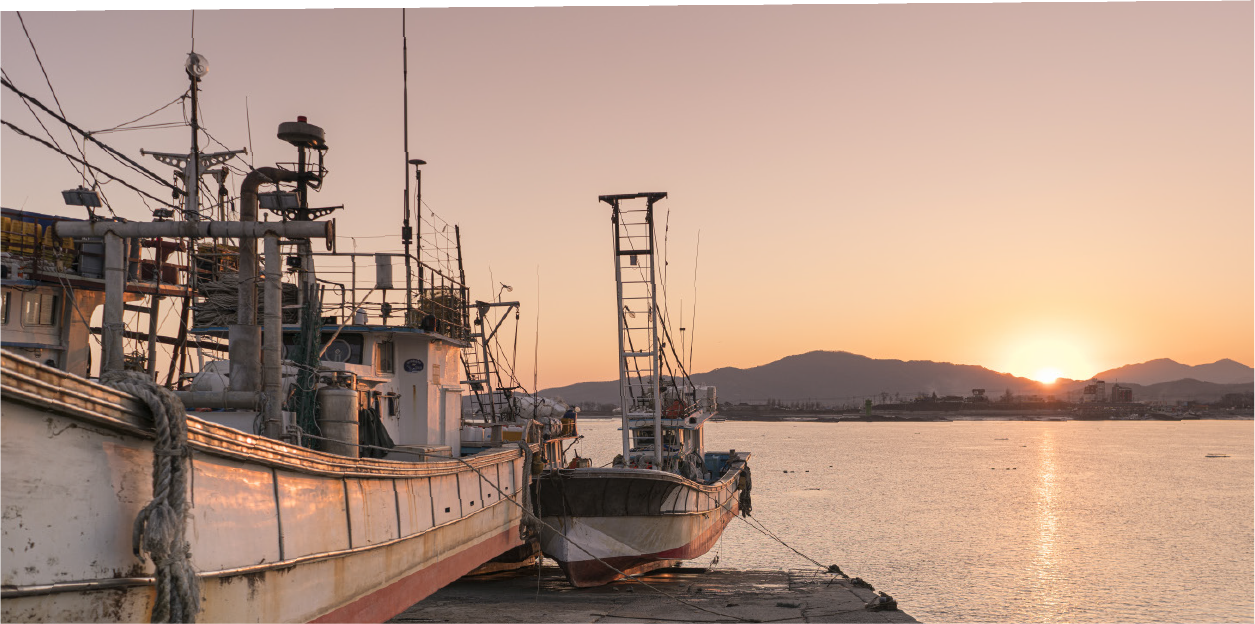
A 20-30 minute walk from Deokpojin will lead to Daemyeong Port. The port is busy with more than 100 fishing boats coming in and going out to the sea. It is the only local port in Gimpo that also serves as a wet market for selling fresh fish, among other seafood caught off the coast. In spring, scaled sardines and webfoot octopuses are caught, while blue crabs come in season in the fall. The port is a great destination for a weekend getaway, where it is interesting to watch fishermen loading and unloading freshly caught seafood at the port. Various fresh seafood including blue crabs, shrimps and webfoot octopuses are available at the wet market that is particularly famous for high-quality salted shrimps and anchovies for Gimjang, or kimchi-making for the winter. The Deokpojin Museum of Education is located close to Daepyeong Quay, right before crossing the Choji Bridge. The museum shows what an elementary school was like in the 1960s and 1970s. On display are Dong A Jeongwa, ‘the King of Reference Books’ for elementary school students and an aluminum lunch box with Wonder Woman imprinted on them.
Old memories, old history, green parks, the ocean with abundant resources and rivers…. Regardless of age and gender, visitors to Gimpo can travel back in time to those good old days and make new memories. Gimpo has a long history, memories, stories, romance and a bright future to offer and share with everyone.
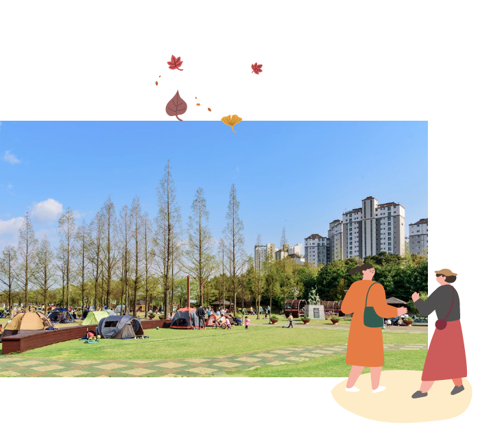
Gulpo Jungang Park, a small neighborhood park in Gulpo-dong, Gimpo is a popular recreational place for local residents. It offers a variety of elements for relaxation and enjoyment including beautiful nature, classic buildings, a children’s playground, walking trails and exercise equipment.
Address: 80-46 Gulpo-ro, Gimpo-si, Gyeonggi-do
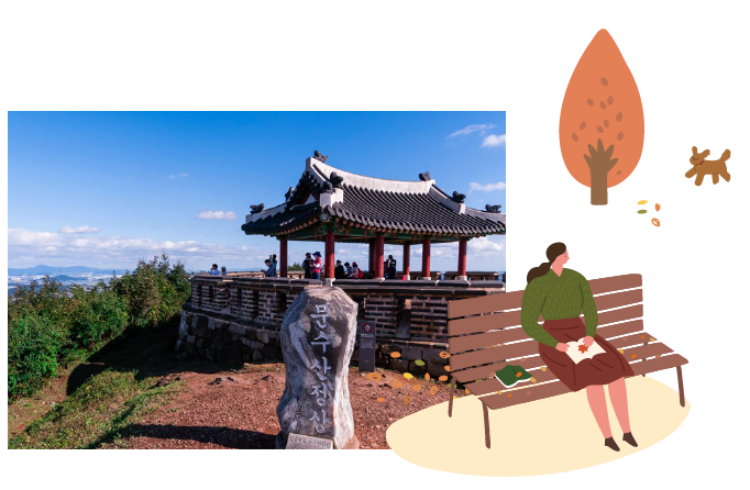
Munsusanseong Fortress together with Gapgotjin Fort was built in the Joseon dynasty to protect the entrance to Ganghwa. It is also the battleground where Korean and French troops fought fiercely in 1866, the 3rd year of King Gojong’s rule. The fortress was built to last by using well-trimmed stones, and at the top of the fortress is ‘Yeojang’, a defense facility to stay concealed. The walls and the gate tower on the coastal side no longer exist, and have become part of the village. Only the walls connecting the ridges remain.
Address: 170 Modamgongwon-ro, Gimpo-si, Gyeonggi-do