Walk Along the Water Path
Singing “Arirang” along
the Water Path on the Island of Jindo
What begins as a creek soon turns into a stream, which grows as wide as a river and flows over 20km, finally meeting the sea. Jindocheon Stream continues to grow in size as it runs through the small town of Jindo and a large area of reclaimed land before joining the sea. Initially, it presents a quiet, routine landscape; in some sections of its course, however, the waterway creates patterns unique to reclaimed land. The waterway originates from a deep valley on a mountain and joins other small waterways before reaching the sea in the southern province of Jeollanamdo Province, creating a uniquely charming landscape of Jindo explored on foot.
Text & Photos by Si-mok Lee (travel writer)
The value of watching the beginning and end of a waterway
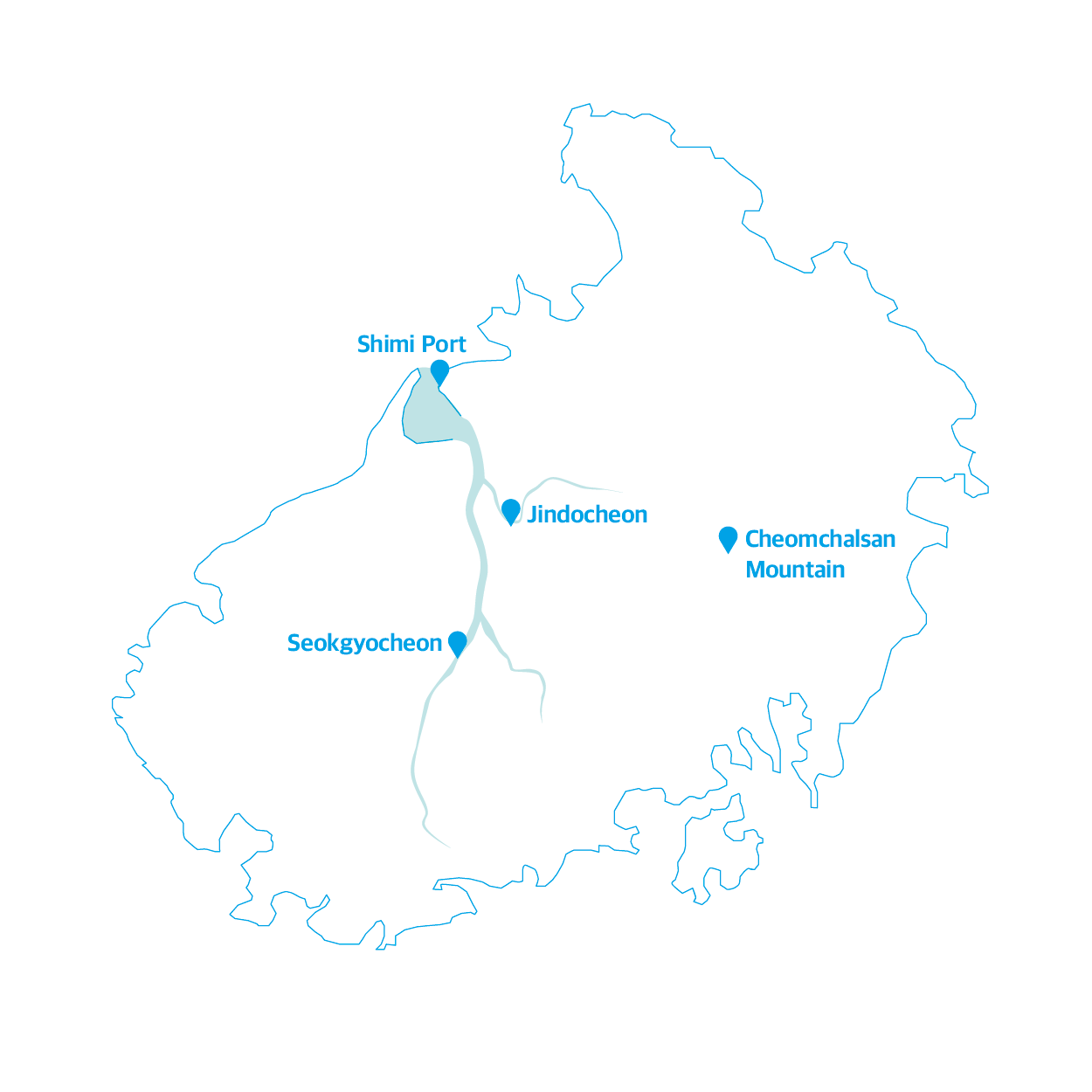
Be it a creek or a river, all waterways have a beginning and an end. Hangang River, which runs through the center of Seoul, originates from Geumryongso, Taebaek and ends in the West Sea. Naeseongcheon Stream winding throughout Bonghwa and Yecheon begins near Sundalsan Mountain—which is part of the Baekdudaegan Mountain Range—and finally joins Nakdonggang River. Jindocheon Stream has its own origin and end. It starts from Suribong Peak(388.5m) of Cheomchalsan Mountain and runs around 10km, almost reaching the sea before finally joining Seokgyocheon Stream in Haechang-ri. Seokgyocheon, the longest stream in Jindo, meets Jindocheon to become a greater waterway and ends in Dadohae. So, walking along Jindocheon Stream, you can learn about the lifecycle of a stream while exploring the mountains and the sea that unfold along the path of Jindocheon Stream.
From Cheomchalsan Mountain that rises 485m above sea level, you can get a bird’s eye view of the life cycle of Jincheondo Stream. Looking down from the top of the mountain, you can get a clear view of the water path of the stream that runs from Jodo Archipelago through the town of Jindo-eup and Haechangdeul to the sea. The way it flows majestically through mountains, forest, villages, and fields reminds viewers of how one’s life passes by through ups and downs. As the lifeline of Jindo, Jindocheon Stream generously wets Haechangdeul and Sopodeul, two large areas of farm fields created on reclaimed land. Streams have benefited humans by helping grow crops and enriched nature over centuries.
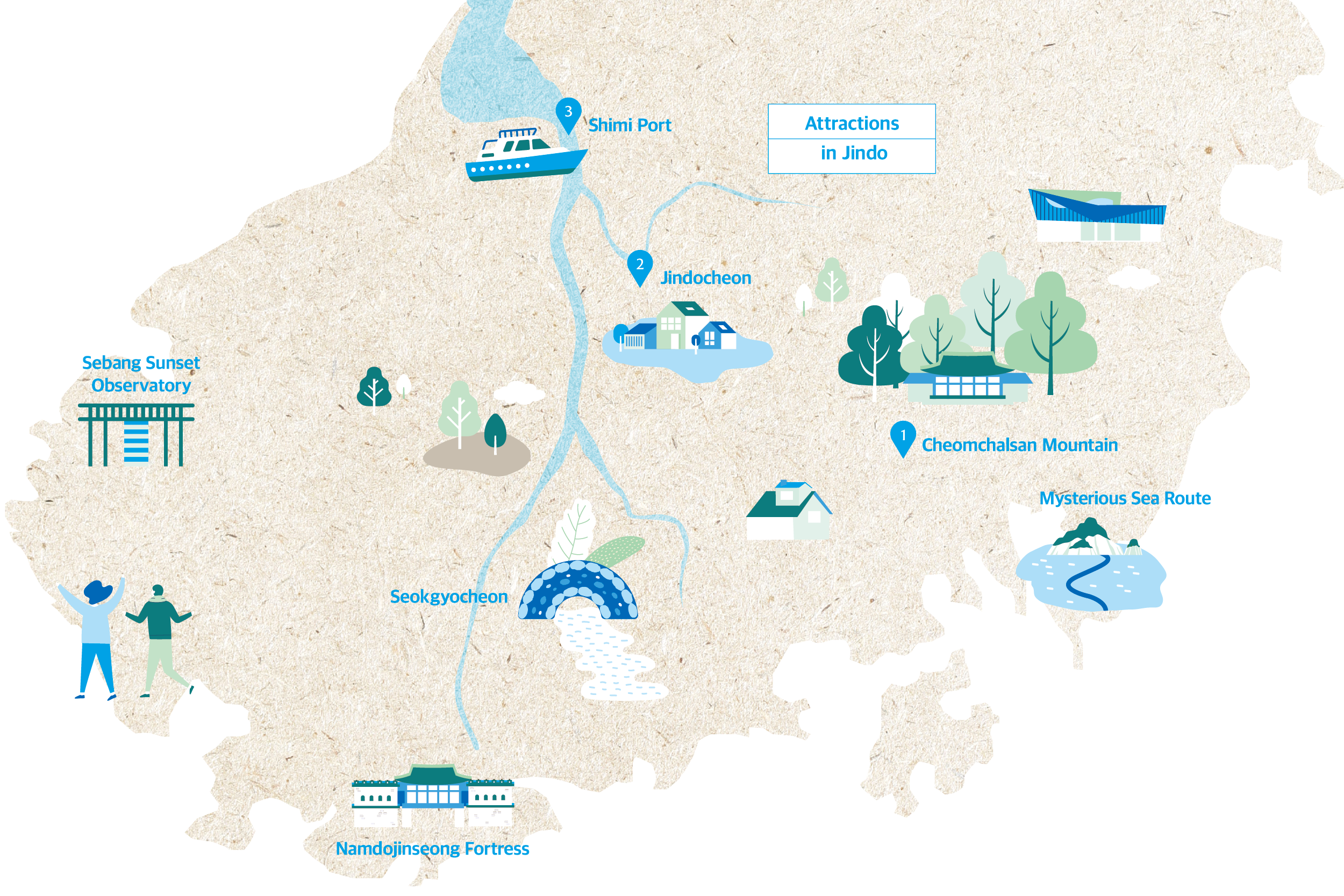
There are some major attractions at the foot of Cheomchalsan Mountain including Ullimsanbang, Ssanggyesa Temple, and Ullimsan Forest Park. Ullimsanbang used to be the residence of Ryeon Huh—known by his pen name So Chi—who was a great scholar and a famous calligrapher of the late Joseon period. It also served as the cradle of Namjonghwa (the Southern School of Chinese Painting), an art style that prevailed in the south of Korea where art flourished for over 200 years. Namjonghwa is characterized by strokes of dry, chapped brushes and bold contrasts of light and shade of ink and wash painting.

The green trees at Ullim Forest Park will make you forget that you are in the middle of winter.
At Ullimsanbang, immerse yourself in vivid and lively landscapes painted in the freewheeling and bold Southern School style. Ssangyesa Temple located right next to Ullimsanbang and Ullim Forest Park that stretches along the ridge of Cheomchalsan Mountain up to half of its height are surrounded by large areas of evergreen forests and coniferous forests. The forests are so green that you may even forget that it is February and mistakenly think that it is either late spring or early summer.

Cheomchalsan Mountain
As mentioned earlier, you can get a panoramic view of the waterway of Jindocheon Stream from Cheomchalsan Mountain, and hiking on the mountain starts at the parking lot of Ssangyesa Temple. The hiking course runs from Ssayngyesa Temple to Samseonam Temple mineral spring, the top of Cheomchalsan Mountain, the three-way intersection at the Seocheonam Temple site, the Arirang Monument (Sacheon Reservoir 1) and finally back to the parking lot. The course takes about three hours. You can drive up to Jindo Meteorological Observatory located near the top of the mountain.
Jindocheon Stream: a green ecological pillar connecting mountains, fields, and sea

Jindocheon Stream runs through downtown Jindo-eup.
Jindocheon Stream
Running through downtown Jindo-eup, Jindocheon Stream paints a picturesque landscape as it flows through Haechangdeul Field, making it an ideal destination for walking.

Seongjukje located past Ullim Forest Park is where the true waterway journey begins. Creeks originating from Suribong Peak flow down to gather in Seongjukje, and the reservoir is a key water source that keeps farm fields wet in spring. If you walk 1.8km from here along the narrow and shallow creek, you will get to the Jindo Arts Center on the outskirts of Jindo-eup. The museum is one of the major organizations committed to popularizing the traditional local music of Jindo. In March, the museum holds the Saturday Folklore Journey every Saturday. The weekly performance features uniquely entertaining local songs of Jindo to the traditional rhythm of yukjabaegi about the joys and sorrows of life.
Some 900m from the center is Jindo Masterpieces Museum, where you can learn to sing a few notes of Jindo Arirang and dance to the song. At this point, Jindocheon Stream grows double in size with the water volume increasing drastically. This is where you can walk along the nicely built embankment. This is the best part of hiking along Jindocheon Stream. You can find some local residents taking a walk and others watching the field of reefs filling the edges of the stream as they take a break from their hectic day and relax. Above all, the vast area of reclaimed land presents a uniquely charming landscape. The field where “Jindo black rice” is grown will turn all green in summer and then golden yellow in autumn. If the wind blows, rice plants will move in the same direction all at once, creating a spectacular scene. Taking a leisurely and romantic stroll along the embankment, you will soon find yourself reaching the old Sopo Quay site located in the middle of Yuroyeonjang of Jindocheon Stream. Wild ducks rest and hunt for food between the densely grown reefs with fish splashing water at times. Today, there is nothing left to show that this used to be part of the sea, but the quay site remains a distant reminder that it was the only quay in Jindo for ferries carrying people between Mokpo and Jindo before Jindodaegyo Bridge was built.
A waterway meets the sea

The beautiful view of the archipelago and the sunset at Shimi Port.
Shimi Port
At Shimi Port, you can take a ferry to Gasado Island and a Jindo tourist cruise ship to enjoy the splendid scenery of the archipelago and Sebang sunset. The cruise takes you on a 1.5-hour route including Shimi Port, Sajaseom Island, Gumungseom Island, Balgarakseom Island, and Songarakseom Island and Buldo Island.

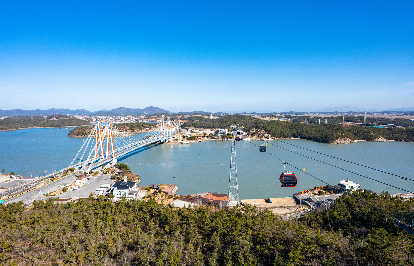
Uldolmok as seen from Jindo Tower and cable car running across Uldolmok.
Jindo has a long history of reclamation, which makes for unique and interesting local geography. Across Jindocheon Stream from Haechangdeul Field are Pogurideul Field and Sopodeul Field, which are as vast as Haechangdeul Field. On the edges of these fields rise mountains named Doriseom, Geunnaeyangseom, and Ttanyangseom, respectively. Here, you can imagine what Jindo may have looked like before the reclamation. Evidence clearly indicates that Haechang Village surrounded by Haechang Field faced the sea in the past. On display at Haechang Village Museum located at the center of the village are old items used by local residents in the past and photos of villagers with their fishing boats in the background. The faded photos show how drastically Jindo has changed over the years.
In the past (geologic era), Jindo was an area of land connecting 256 islets including Jindo, Sangjodo, Hajodo, and Gasado. Later, the sea level rose, splitting the land into a number of islets. Back then, the small and pretty islets were probably seen through layers of sea fog. Fog would get even thicker in spring, making hundreds of islets look like mirages as they kept popping up and disappearing through the thick layers of fog as if playing hide and seek, just like the mysterious sea route as one of Jindo’s major attractions.
Leaving behind the landscape that may have existed thousands of years ago, the road stretched around 3km along the waterway from Haechangdeul Field past Daeshin Industrial where Jindocheon Stream and Seokgyocheon Stream meet at the Sopo breakwater. The breakwater was built for the reclamation of Sopo bay, at the end of which is the sea. Instead of a vast area of farmland, some ten fishing boats greet you at Shimi Port where Seokgyocheon Stream finally joins the sea. If you happen to be at Shimi Port, the sunset there is worth watching. Small islands of the archipelago including Jeodo, Sojeodo, and Jakdo line up like steppingstones against the beautiful sunset. What started as a stream ends in the sea, and a day of walking along the waterway ends with the sunset.

