Focus on

Countdown to the Opening of the Age
of Satellite-Based Water Management

The world’s first water resource satellite

The world’s first satellite dedicated to water resources management and water disaster monitoring
that is being developed under the leadership of the Ministry of Environment is scheduled to be
launched in 2027. As a key resource for water security, the satellite will usher in a new era of water management.

📝Text by. Editorial Team /  💾Source. Water Resources Satellites Center of the K-water Research Institute

A real-time water resources monitoring system
to respond to the worsening climate whiplash

The world is getting increasingly plagued by climate whiplash, or abrupt shifts between drought and flood. A case in point is the massive forest fire that occurred in LA, US in January 2024. The fire spread quickly, fueled by dry weather and trees and plants that had grown rapidly on increased rainfalls during winter. Climate whiplash is becoming more frequent and severe as global warming continues to accelerate. Rising temperatures lead to greater evaporation, which in turn creates a vicious cycle of intensifying flood and drought. Dry weather causes water to evaporate more quickly, so the surface of Earth gets dry and heavy rainfalls occur in the wet season.
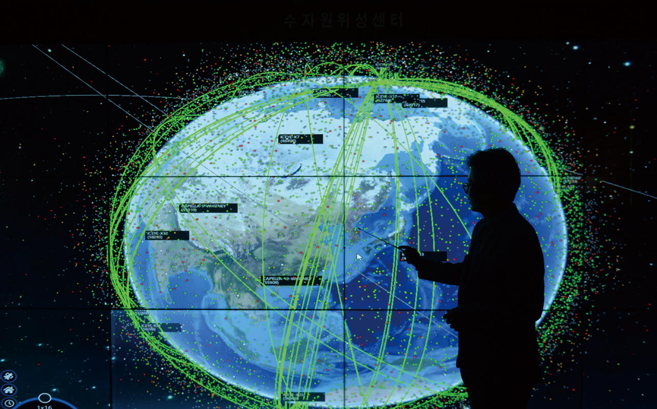
Amid the accelerating global warming, water disasters are becoming more frequent and increasingly intense across the globe. In order to monitor and respond to extreme weather transitions, the Korean government has embarked on developing a satellite dedicated to water resources management and creating a ground operation system for water disaster monitoring based on weather data collected by the satellite.

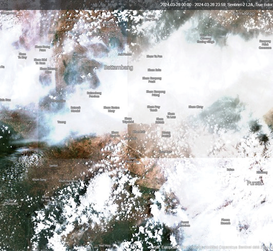
NASA is operating weather-monitoring satellites, but there is no satellite developed exclusively for water resources management. Korea has purchased data collected by satellites operated by Finland and other countries or used public satellite data that is disclosed for free. However, the resolution of satellite images and observation cycle vary by satellite; thus limiting the accuracy of data analysis.
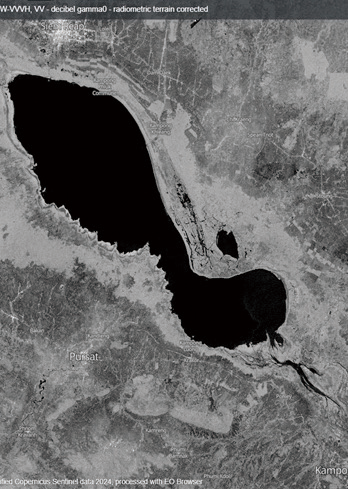
Domestic satellites generate images using mainly visible rays, making it difficult to obtain data in bad weather or at night. There is also a limit as to what can be done for precise monitoring of tributaries and real-time monitoring of fast-changing weather events. For this reason, the government launched the development of the world’s first satellite for water resources management in October 2022.

K-water CEO Seogdae Yun is listening to an official of Korea Aerospace Industries, Ltd., in Sacheon, Gyeongsangnam-do as the latter explains the satellite project.

Golden Time in Flood Forecast and Flood Alert Secured by the Imaging Radar Capturing Accurate Images through Rain Clouds

The Water Resources Satellites Development Project is underway as one of the national R&D projects of the Ministry of Environment and the Ministry of Science and ICT. Korea Aerospace Industries (KAI) and Korea Aerospace Research Institute (KARI) are responsible for developing the main body of the satellite and the payload, respectively. K-water is working on creating a ground operation system for water disaster monitoring based on satellite-generated data, including a system to use the data. Phase 1 is a national R&D project wherein a medium-sized satellite exclusive for water resources management will be developed. In Phase 2, a ultra small satellite constellation being developed by K-water will be linked to the satellite to build an upgraded water resources monitoring system with enhanced accuracy.
Scheduled for launch in 2027, the satellite named “Next-Generation Medium Satellite 5” will observe water resources in the Korean Peninsula twice a day. In particular, the key component C-band SAR (Synthetic Aperture Radar)—unlike the electro-optical sensor that needs sunlight to perform—uses microwave, so it offers the advantage of being able to conduct observation regardless of clouds, rain, or darkness. Moreover, the ability to create 3D effects makes the satellite ideal for detecting meteorological changes including floods and droughts and abnormalities in water quality.

The K-water SAT being developed by K-water in Phase 2 is a constellation of 4 ultra small satellites that will observe the Korean Peninsula three times every two days. The constellation will be connected to Next-Generation Medium Satellite 5 to increase the observation frequency and monitor narrow scopes of areas at a high resolution. Since it can observe surface structures or shapes, it will be used in various fields including protecting major state properties such as dams and waterworks, monitoring algal blooms, observing key facilities in border areas, and analyzing vegetation.
Each year, Korea has been experiencing difficulty with water management due to dam discharges in border areas without prior warnings. Currently, we are responding to dam discharges by North Korea by adjusting the water levels downstream. Going forward, however, the weather satellite will allow us to monitor, analyze, and share information on dam discharges without prior notice. This way, we can respond to potential water disasters in real time and secure the golden time in issuing flood warnings and alerts.

Details of Individual Satellites
  • Water Resources Satellites
    (Next-Generation Medium Satellite 5)
    • Type of Payload C-band SAR (imaging radar)
    • Scope of Observation at least 120 km
    • Resolution 10 m × 10 m or less
    • Weight 500 kg
    • Altitude 561 km
    • Observation Cycle 2 times/day (the entire Korean Peninsula)
  • Ultra small satellite Constellation
    (K-water SAT)
    • Observation Method Optical
    • Scope of Observation 12km
    • Resolution 1.0m
    • Weight 30 kg or less
    • Altitude 561km
    • Observation Cycle 3 times/2 days (daytime observation)

Electro-Optical Sensor vs. SAR (based on the same location & similar time frame)

  • Electro-Optical (EO) Sensor
    • Electromagnetic wave visible rays
    • Strength able to produce images similar to what the human eye sees
    • Weakness unable to observe at night or in bad weather conditions
    • Uses satellite maps, agriculture, forest observation, etc.
  • Imaging Radar (SAR)
    • Electromagnetic wave microwave (C, P, L, X band, etc.)
    • Strength able to observe at night and regardless of weather conditions
    • Weakness lower resolution compared to the EO sensor
    • Uses real-time monitoring of water resources, water disasters, national defense, and other disasters
Euiho Hwang, head of the Water Resources Satellites Center of the K-water Research Institute, is explaining the expected orbit of the Water Resources Satellites scheduled for launch in 2027

A Global Research Cooperation Network
for Forecasting and Responding to Climate Disasters

The Water Resources Satellites will serve as an important tool for K-water to expand international R&D cooperation and technology export, with the ultimate goal of laying the foundation for Korea to rise as a climate technology industry powerhouse. K-water is working closely with the International Charter—a global collaboration among 17 countries for satellite imagery-based disaster response—to collect and transmit satellite data on major climate disasters and to provide satellite data for prompt response. Satellite imagery proved to be vital when K-water analyzed the flood damages caused by the collapses of dams in Ukraine and Libya and earthquake damages in Morocco in 2023.
Furthermore, K-water will participate in Horizon Europe—the world’s largest joint research program funded by the EU—and work with DLR, the German Aerospace Center (DLR) on developing technology to improve the quality of global satellite-based climate change services. K-water plans to integrate this technology into the water management digital twin platform that it is currently building in Jeddah, Saudi Arabia, provide satellite-based flood analysis data, and create an export model for satellite imagery analysis technology.

International water industry information analysis agency Global Water Intelligence predicts that, in the next 10 years, losses resulting from natural disasters will be USD 1.8 trillion, 69% of which will be related to water disasters including heavy rainfall, floods, and droughts. The impact of climate change is most evident in water disasters; in this context, resource satellites and satellite imagery analysis technology are expected to be the core technological asset in coping with future water challenges.
The construction of the Water Resources Satellites Center of the K-water Research Institute for the ground operation will be completed in Sejong City in the second half of the year. The center will perform the role of a control tower that receives and analyzes data from the Water Resources Satellites scheduled for launch in 2027, and monitor water disasters including flood and drought, water quality, and water resources. It will also serve as a base for global cooperation in responding to climate change through ultra-precise water disaster management technology and climate technology market leadership.